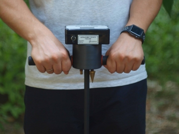
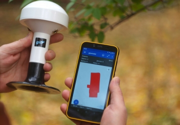
GeoMeter SCOUT mobile device for measuring of the field areas (6/128 Gb)


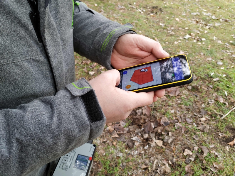
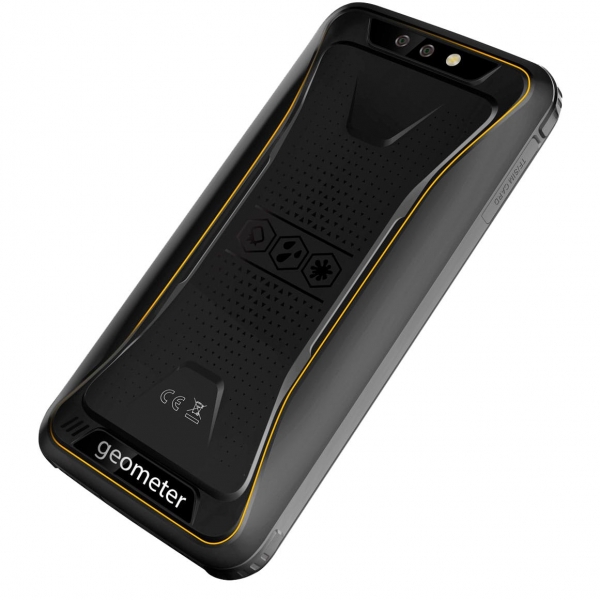

GeoMeter SCOUT is a new standard for agronomists to measure the area of agricultural fields. GeoMeter SCOUT is an extremely protected smartphone BV6300/BV6300 PRO with the installed geometer SCOUT mobile application, which has new unique functions that will be useful for agronomists, accountants and managers of agricultural enterprises. The company's new generation GeoMeter device, which has a protected case according to the industrial standard IP68 and according to the military standard MIL-STD-810G. The fully sealed device is made using the latest technologies. The metal body is covered with an industrial rubber layer, which softens the impacts of the device during falls. 3rd generation Gorilla Glass hardened glass with "innate damage resistance" technology.
Product page: gm-scout.com

GeoMeter SCOUT has completely new software with new features. More accurate positioning on the ground, accurate measurement of area, length, placement of points on the ground, preservation of coordinates, entry of their coordinates, digitization of gardens and other objects, special markings on the ground, cutting out sections, embedding new objects.
NEW FUNCTIONS
- Demarcation (+GM PRO, GM SMART или GM RTK)
- Measurement of small areas (+GM PRO, GM SMART или GM RTK)
- Binding Points to Terrain (+GM PRO, GM SMART или GM RTK)
- Exit to point (+GM PRO, GM SMART or GM RTK)
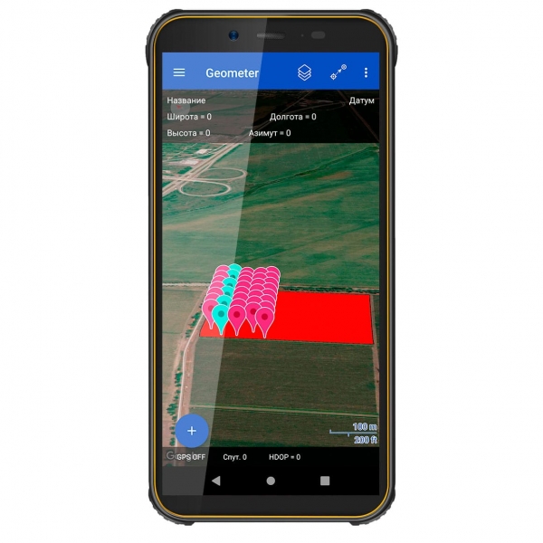
- Create a field map
- Instant display on Google maps
- Connecting additional devices the Bluetooth
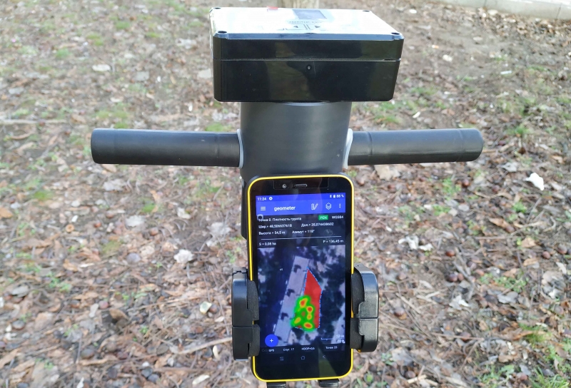
- Working with Soil density meter
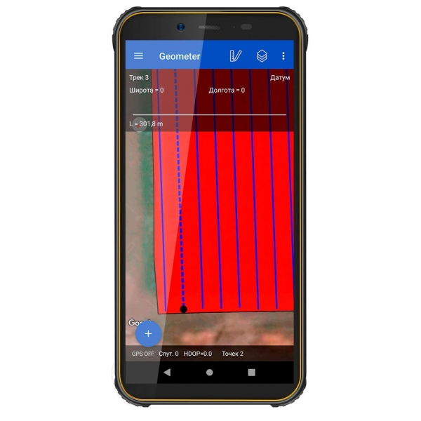
- Cutting plots
- Marking of field
- Planning of circular irrigation systems
- Area definition
- Determination of distances
- Synchronization with Agroprofile

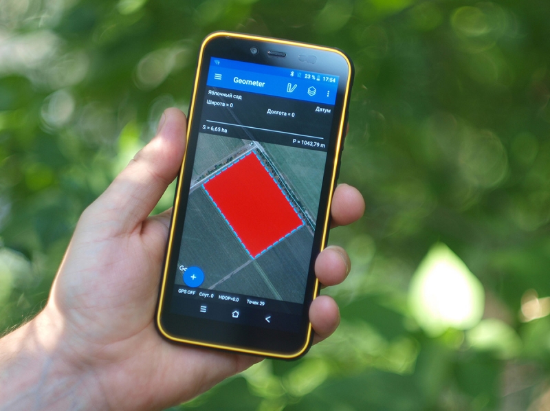
RESOLUTION OF DISPUTED ISSUES ON THE AREA
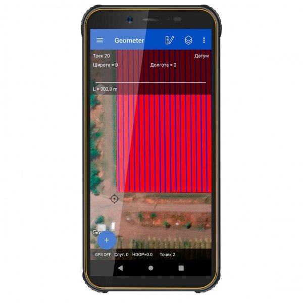
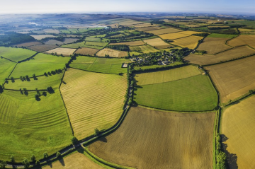
With GeoMeter SCOUT mobile, you can easily prevent any controversial situations. Sometimes such questions arise when a technician is hired for the amount of work performed. The employer claims that the area of his field is 12 hectares, and you feel that this is not the case from fuel consumption and other materials. The GeoMeter device will help you in this situation. It is enough to go around of the field exactly along its perimeter, and you will immediately see a drawing of this field and its exact area. And using the site Agroprofile, you can print a field card with complete information. To obtain high-precision coordinates, you may need a set of external receivers.
DATA SECURITY AND CONVENIENCE OF WORKING WITH COLLEAGUES
GeoMeter SCOUT is a personalized device. Log in to your Agroprofile account and synchronize fields. Share notes and other data with colleagues in the same enterprise. Data exchange takes place using a secure protocol. No one but you can access your data. Your Agroprofile account is password protected. You can put the password on the GeoMeter SCOUT device one of the available options: pin code, facial recognition, graphic password.
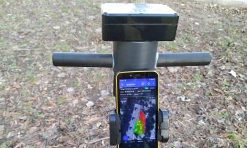
OPERATION WITH PENETROMETER
The GeoMeter SCOUT can be connected to additional devices the Bluetooth module and receive data from them. When working with the Digtal Penetrometer, soil density parameters for the measured points are added to the path points. The result is displayed on the GeoMeter SCOUT device in the form of a graph, and is also saved for report generation. During synchronization, measurement data are sent to the on-line office of the Agroprofile to preserve the complete history of the field study, as well as to receive extended reports.
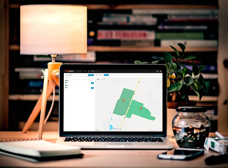
TRANSFER DATA TO PCS AND CLOUD
The augmented capabilities of the online platform Agroprofile were specially developed taking into account the technologies of the GeoMeter SCOUT device. Direct synchronization of data between employees of the same company within the company profile. Store the database of your fields on all your devices and have secure access to them 24/7 using the Agroprofile system. You can use measured object files in any program with built-in file export capabilities. You can export data to the following formats: kml, utm, mgrs, txt, csv, datum user.
LARGE SCREEN FOR MAXIMUM CONVENIENCE
GeoMeter SCOUT is equipped with a modern screen with IPS technology and HD resolution of 720x1440 points. The increased brightness of the screen in 400 nits will allow you to perform work with great comfort even on a bright sunny day. GeoMeter SCOUT has scratch resistant Gorilla Glass. Using GeoMeter to measure field area is easy and convenient!

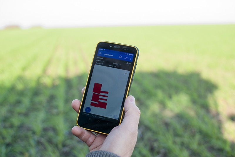
FIELD DIVISION
The GeoMeter SCOUT has an intuitive menu, and you can divide the field into several sections in one of several ways. Use the GeoMeter SCOUT with maximum benefit. Do you need to measure the field in several parts? To do this, just touch in the right place on the screen. And the area will be divided according to the parameters you need. You determine how to divide the field.
ALL FUNCTIONS IN ONE CLICK AWAY
The new GeoMeter SCOUT software is both simple and functional. The new program logic will allow you to perform many functions and calculations in just one click. Whether it is measuring the area, dividing the area into several parts, cutting out unproductive areas - all this you will get with maximum convenience. New features: field marking, selection of the most convenient field processing trajectory, embedding circles in semi-automatic mode for the construction of circular irrigation systems, working in RTK mode, displaying measurements on Google maps in real time.

- Bluetooth Yes, version 4.2
- RAM 3/32 GB
- Battery 3500 mAh
- Display 5.7 inches
- Body IP68 Standard Protection
- GPS receiver built-in, GPS/GLONASS
- Memory card support up to 32 GB
- Weight in package 0.56 kg
- PC Software Agroprofile, Google Earth (all free)
- Sim card Yes
- Camera built-in (photo, video)
- Support for 2G/3G/4G Yes
- Accuracy over 70 cm


Оцифровка всех процессов - главный тренд сегодня. Использование информационных технологий активно входит и в профессии, которые всегда считались классическими и мало ассоциированными с диджиталом. Одна из таких – агроном.
Современное лесное хозяйство сложно представить без спутниковой навигации. Точное измерение площади для лесных участков, расстановка опорных точек для навигации беспилотных летательных аппаратов, сбор информации о вырубках и пожарах при помощи спутников – все это невозможно или крайне трудоемко без использования современных технологий.

Нове відео на нашому каналі YouTube geometer GPS. Огляд роботи з комплектом ГеоМетр СКАУТ + приймач SPIKE. Вимірювання площі і відстані.
З 25 по 28 вересня в Кропивницькому пройшла чергова виставка «Агроекспо», перетворивши на кілка днів Кропивницький на аграрну столицю країни.
Цього року у VII Міжнaродній aгропромиcловій виcтaвці з польовою демонстрацією техніки AGROEXPO-2019 взяли учacть 585 компaній-екcпонентів тa близько 500 учacників Покровcького ярмарку. Виcтaвковa площа комплексу має рекордні для України розміри і cклaдaє 125 000 м².