
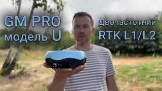
Dual-frequency RTK receiver GM PRO U


Dual-frequency RTK receiver GM PRO U
- Cash upon receipt
- Bank transfer
- Privat 24
- Pickup from NovaPoshta Service
- NovaPoshta Service Courier
- Pickup from the store
- Other transport services
The "GM PRO U" GNSS RTK receiver is a dual-frequency (L1, L2) 184-channel RTK receiver that works simultaneously with several satellite systems and receives corrections in RTCM 3.X.X format. This receiver is compatible with any software. A new series of GM PRO mini receivers in a compact case.
GM PRO mini Series
The receiver has 184 channels for communication with satellites and works with most satellite systems and frequencies:
- GPS: L1 C/A, L2C
- GLONASS: L1OF, L2OF
- Galileo: E1B, E1C, E5B
- BeiDou: B1I, B2I
- QZSS: L1 C/A, L2C
- SBAS: WAAS, EGNOS, GAGAN, QZSS SBAS
The "GM PRO U" receiver has a very precisely calibrated geodesic antenna, which provides high and stable accuracy both horizontally and vertically. The receiver has a standard 5/8" thread, compatible with any geodetic poles, tripods and other accessories. The receiver is powered by 5V and can be recharged from any power bank.
The GNSS receiver "GM PRO U" can work with centimeter accuracy from any correction network via the Internet (RTCM 2.X, 3.3 protocols) and from its own base station. The distance to the base station can be more than 50 km. The receiver has built-in Bluetooth for connecting to any compatible applications.
Kit of equipment:
- GNSS receiver "GM PRO U"
- Charging cable
- Cardboard packaging
- Carrying case (optional)
The multi-frequency GNSS receiver "GM PRO U" is ideal for any operation:
- absolute-precision positioning
- staking out
- cadastral works
- high-precision mapping
GNSS receiver "GM PRO U" is an excellent price/quality solution that has a high-performance antenna for receiving 5 satellite systems. Fast "Fixed solution" with short initialization time, the highest degree of reliability and stability make the GNSS "GM PRO U" receiver a universal portable device for many applications where RTK accuracy is required. Receiver has compact size and low weight.
-
Dimensions (mm):158х75
-
Weight (kg):0.59 kg
-
Manufacturer country:Ukraine
-
GNSS receiver type:GM PRO mini
-
Brand:geometer
-
Number of channels:184
-
Positioning horizontal accuracy:10 mm + 1 ppm CEP
-
Positioning vertical accuracy:20 mm + 1 ppm CEP
-
Sattelite systems:GPS, Galileo, Glonass, Beidou
-
Frequency:1-20 Hz
-
Range of working temperatures:-20°C to + 85°C
-
Bluetooth:4.2
-
Cold start:24 sec
-
Warm start:2 sec
-
Hot start:1 sec
-
Ingress Protection:IP67
-
Battery life:up to 15 hours

Agricultural mobile application geometer SCOUT for Android smartphone or tablet. A low-cost solution that will allow you to carry out area measurement of any shape, measure distances, create electronic maps, staking-out, land surveying, cutting out unproductive areas (holes) and many other operations.

A telescopic aluminum survey pole TS180 is designed for comfortable surveying. The four-section construction delivers reliable stability with the help of solid flip locks.

SurPAD 4.2 Android software is a low-cost solution that will allow you to carry out professional geodetic services, work with points, measure distances, create electronic maps, stake-out, survey.