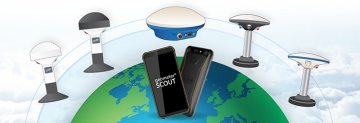
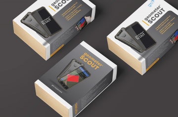
Geometer App with GM Spike receiver (area measurement)
")

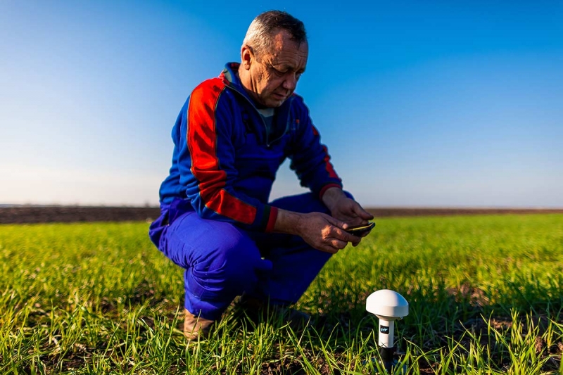


The geometer application for measuring field area on your tablet/phone with a GM Spike receiver (SBAS) is the optimal set for measuring area, distances and setting points. An external receiver with an antenna is used to improve the sensitivity and quality of the GPS signal. You can independently carry out the necessary work with the area, namely: professional measurement of the area of fields of any shape, measurement of distances, access to the point, surveying, cutting out unproductive areas, create electronic maps and many other operations with the area. To improve accuracy, use the configuration with the GM SMART receiver or with the GM RTK receiver.
Product page: gm-scout.com
As a monitor, you can use your tablet or smartphone with Android OS, on which geometer app licensed software from GeoMeter company of Ukraine will be installed. This software includes technical support directly from the developer. In addition, the program is regularly improved and updated in accordance with the needs of modern farmers. If necessary, you can update your program to the latest version yourself. The receiver is connected to your device using a wireless Bluetooth connection or USB (optional). Such a kit will be useful for those types of work where high accuracy is important.


To install the software, you will need a device with the following technical parameters:
| operating system | Android, version 9 and higher |
| Google services | required (Google Maps, Play Market) |
| Screen diagonal | 7 inches or higher |
| RAM | 2 GB or higher |
| Dedicated memory for a single application | 192 MB or higher |
| Bluetooth | Yes |
| Wi-Fi | Yes (if Agroprofile reports are needed) |
| Sim card | if you need online tracking |
Variants of complete set:
1. geometer + GM Spike receiver (battery)
The set includes a GM Spike receiver with a built-in battery. The connection type is Bluetooth.
2. geometer + GM Spike receiver (no battery)
The set includes a GM Spike receiver without a battery. The connection type is USB.
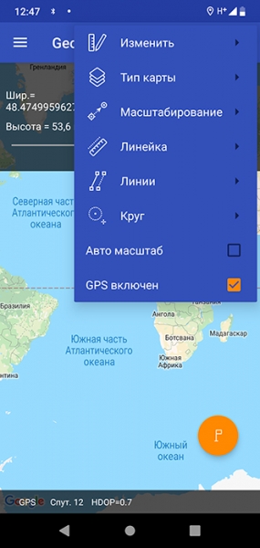
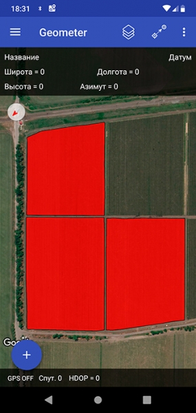
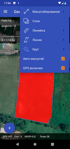
geometer is a completely new software with new features. You will be able to more accurately position on the ground, accurately measure area, length, three-dimensional measurement, place points on the ground, maintain coordinates, enter your coordinates, digitize gardens and other objects, special markings on the ground, carve sections, embed new objects. All control is performed by a single touch to the screen. The program has an intuitive menu, so it does not require special user training.


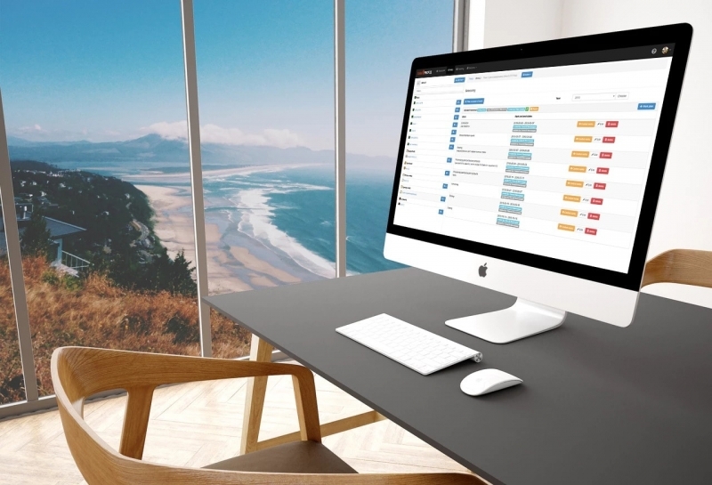
Synchronization of fields and works on the Wi-Fi/3G/4G/LTE with the portal Agroprofile will greatly facilitate the work with the device and will provide the possibility of automatic transfer of the received measurements to the free portal www.agroprofile.com for convenient planning and control of agricultural work. This will allow you to store all your fields and work in one place, and more effectively control all work processes.
NEW FUNCTIONS
- Surveying (+GM PRO, GM SMART или GM RTK)
- Small area measurement (+GM PRO, GM SMART or GM RTK)
- Binding points to terrain (+GM PRO, GM SMART or GM RTK)
- Point Output (+GM PRO, GM SMART or GM RTK)
- Create a field map
- Working with Cadastre
- Instant display on Google maps
- Count the number of hounds when working with wide-grasping equipment
- Cutting Parcels
- Field Layout
- Planning of circular irrigation systems
- Area Definition
- Determining Distances
- Synchronization with Agroprofile


GM SPIKE RECEIVER CHARACTERISTICS
Case: dust and moisture protected
GPS receiver: Single frequency, L1
Bluetooth: is, version 4.2
Number of channels: 56
Frequency: 1 Hz, 2 Hz, 4 Hz, 5 Hz, 10 Hz
Weight: 0.3 kg
Diameter: 110 mm
Height: 180 mm
Connector type: USB - 5.5x2.1
Battery: Li-ion, up to 10 hours of operation
Mount: neodymium magnets

RESOLUTION OF DISPUTED ISSUES ON THE AREA
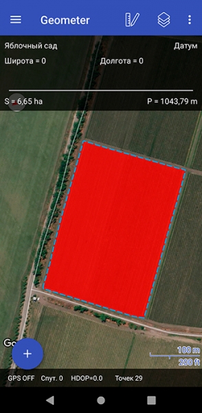
With the geometer Software, you can easily prevent any contentious situations. Sometimes such questions arise when a technician is hired for the amount of work performed. The employer claims that the area of his field is 12 hectares, and you feel that this is not the case from fuel consumption and other materials. The GeoMeter device will help you in this situation. It is enough to bypass or tour the field exactly along its perimeter, and you will immediately see a drawing of this field and its exact area. And using the site Agroprofile, you can print a field card with full information about it.

DATA SECURITY AND EASE OF WORKING WITH COLLEAGUES
The geometer program is personalized. Log in to your Agroprofile account and synchronize fields. Share notes and other data with colleagues in the same enterprise. Data exchange takes place using a secure protocol. No one but you can access your data. Your Agroprofile account is password protected.
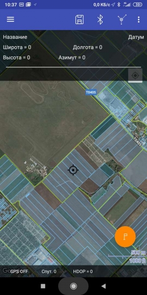
POSSIBILITY OF WORKING WITH A CADASTRE
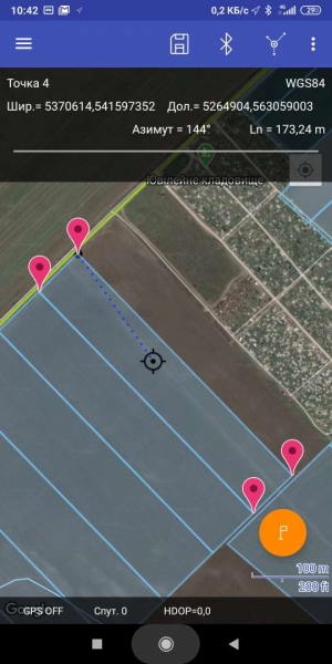
A special layer "Public Cadastral Map of Ukraine" has been added to the geometer program, which will allow you to visually display your location relative to the boundaries of your site. It is possible to set extreme points with their preservation for further access to them.


OPERATION WITH PENETROMETER
The geometer program allows you to connect your device to additional devices using the Bluetooth module and receive data from them. When working with the Digital Penetrometer, soil density parameters for the measured points are added to the path points. The result is displayed on the GeoMeter SCOUT device in the form of a graph, and is also saved for report generation. So you can get a color density map of any field on your device in an easy-to-understand way.

DATA TRANSFER TO PC AND CLOUD TECHNOLOGIES
Save the database of your fields on all your devices and have secure access to them 24/7 using the Agroprofile system. You can use measured object files in any program with built-in file export capabilities. You can export data to the following formats: kml, utm, mgrs, txt, csv, datum user.
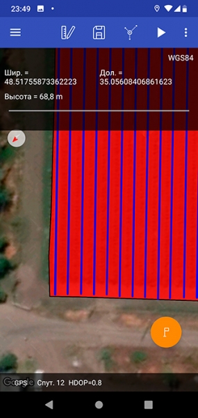
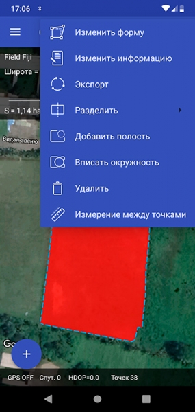
FIELD DIVISION
The geometer software has an intuitive menu, and you can divide the field into multiple sections in one of several ways. Make the most of the program. Need to measure a field in several parts? To do this, just touch in the right place on the screen. And the site will be divided according to the parameters you need. You decide how to divide the field.
ALL FUNCTIONS IN ONE CLICK
Completely new geometer software - both simple and functional. The new program logic will allow you to perform many functions and calculations in just one click. Whether it is measuring the area, dividing the area into several parts, cutting out unproductive areas - all this you will get with maximum convenience. New features: marking the field by gon, selecting the most convenient field processing path, embedding circles in semi-automatic mode for the construction of circular irrigation systems, working in RTK mode, displaying measurements on Google maps in real time.

- Country of manufacture Ukraine
- Synchronization with Agroprofile automatic
- Receiver Type GM Spike
- Accuracy 50-70 cm
Оцифровка всех процессов - главный тренд сегодня. Использование информационных технологий активно входит и в профессии, которые всегда считались классическими и мало ассоциированными с диджиталом. Одна из таких – агроном.
Современное лесное хозяйство сложно представить без спутниковой навигации. Точное измерение площади для лесных участков, расстановка опорных точек для навигации беспилотных летательных аппаратов, сбор информации о вырубках и пожарах при помощи спутников – все это невозможно или крайне трудоемко без использования современных технологий.
Измерение площади полей - это основа, с которой начинается любое агропроизводство.
Знание точных площадей позволит правильно и разумно распределить различные ресурсы предприятия, такие как, топливо, семена, удобрения, СЗР и т.д.
Чтобы получить достоверную информацию о площадях полей, достаточно использовать GPS прибор со специализированной программой, и желательно, с внешним приёмником для улучшения точности.
Используя GPS прибор для измерения площади агроном получает важные данные: площадь, периметр, длину, и на основе этих данных получает цифровую карту полей.