DIGITALS software for land management and Cartography

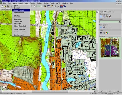
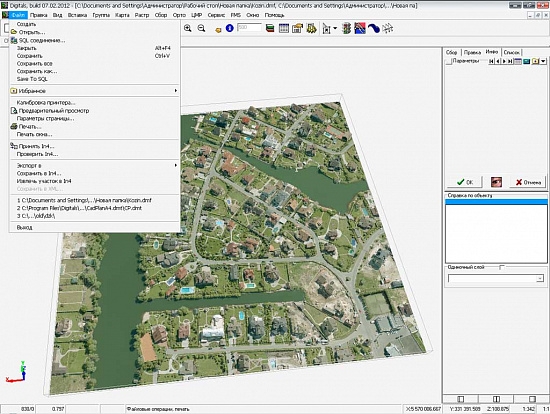
Digitals software automates geodesic work from field measurement processing to the creation of exchange files, cadastral plans and technical documentation. Does not require additional programs such as Autocad or MapInfo. Creates graphical and text documents based on customizable templates, allowing you to automate the process as much as possible and easily adapt it to any requirements. In Digitals, you can create topographic and special maps and plans, accumulate a cadastral database, build relief models and model contours, calculate areas and volumes, view maps in three-dimensional form, use satellite images, orthophotoplanes and scanned maps, create text and graphic documentation.
Digitals Benefits:
- all geodesy and land administration in one license program;
- compatibility and versatility;
- A versatile platform with a huge set of features
- a powerful mapping core;
- Professional development team;
- downloading satellite images from Google Maps and Virtual Earth and PKK;
- inserting and quilting multiple screens into a map
- multi-user operation mode;
- advanced tools for editing maps and plans;
- built-in programming language;
- Working with bitmap images
- Displays maps in 3D view.
Geodesic Measurement Processing (Geodesy)
Allows you to import data from most electronic tacheometer files, or enter a measurement log manually, build various types of traverse moves, conduct their joint equalization with the output of reports on results. Monitors errors in the input data so that measurements can be corrected. The resulting station coordinates are then transferred to the main Digitals module.
Creating Table-Text Reports (Reports Module)
Allows you to automatically create documents ready for printing, such as the coordinate catalog, land book, Form 6-zem, registration card, etc., based on the information contained in the map or exchange file. Based on the Fast Reports kernel. All document templates are customized by the user. You can create your own reports and documents. Contains a built-in language that allows you to further process data when generating a report. The module fully automates the issuance of technical documentation for the land plot.
Semiautomatic Vectorizer (Topotracer module)
The vectorizer is optimized for the digitization of topographic elements, such as contours, point contours, elevation elevations, etc. Applicable for semi-automatic vectorization of various schemes and plans. Allows you to perform vectorization without preprocessing and bringing the raster to a monochrome representation. Contains tools for quickly assigning height to contours, editing objects, smoothing/thinning contours, and adding semantic information. A convenient digitization process does not require constant switching to manual mode when passing through complex areas - this is done automatically. Provides fast, multi-gigabyte bitmaps. Easy to learn and use.
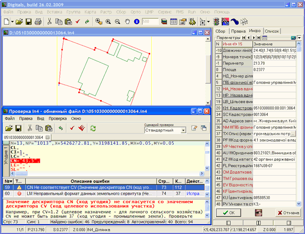
Checking XML Cadastral Exchange Files (XMLChecker)
Checks whether data is correctly populated in XML when it is written. Shows the found geometry and attribute errors and helps correct them. Also converts exchange In4 files to XML. Contains a built-in script language that allows you to modify and configure validation criteria.