Agricultural guidance system geotrack GM SPIKE with 8 inches display

AGRICULTURAL GUIDANCE SYSTEM GEOTRACK WITH GM SPIKE RECEIVER AND 8 INCHES DISPLAY.
BUDGET SOLUTION FOR PARALLEL DRIVING
The set is based on the Android tablet and the GM SPIKE receiver. The GM SPIKE receiver is adapted to work with parallel driving systems and significantly facilitates work with wide-grip technology. Designed to receive signals from GPS and GLONASS satellites. Provides basic accuracy of parallel driving, at the level of 40-50 cm from row to row.
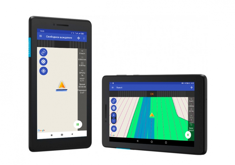
The system presents information on the screen for accurate control of the technique, records the path of the technique in the form of a track and accurately calculates the processed area. With licensed geotrack software, this set will be comfortable and easy to use. All control is performed by a single touch to the screen. If necessary, you can update your program to the latest version yourself. It has an intuitive menu, so it does not require special training of the machine operator.
 Synchronization of fields and works on the Wi-Fi/3G/4G/LTE with the portal Agroprofile www.agroprofile.com will greatly facilitate the work with the device and provide the possibility of remote control by the manager of workers in the field.
The set of parallel driving is suitable for such works as sowing, spraying plants from weeds and pests, application of mineral and organic fertilizers. The sharing of the GM Spike receiver and the geotrack program makes it possible to accurately manage agricultural machinery in the field in conditions of poor visibility - at night, in fog, in conditions of heavy dust.
VIDEO DEMONSTRATION IN WORK:
COMPLETE SET:
- Lenovo Tab 7 Tablet
- GM Spike Receiver
- Geotrack License Program
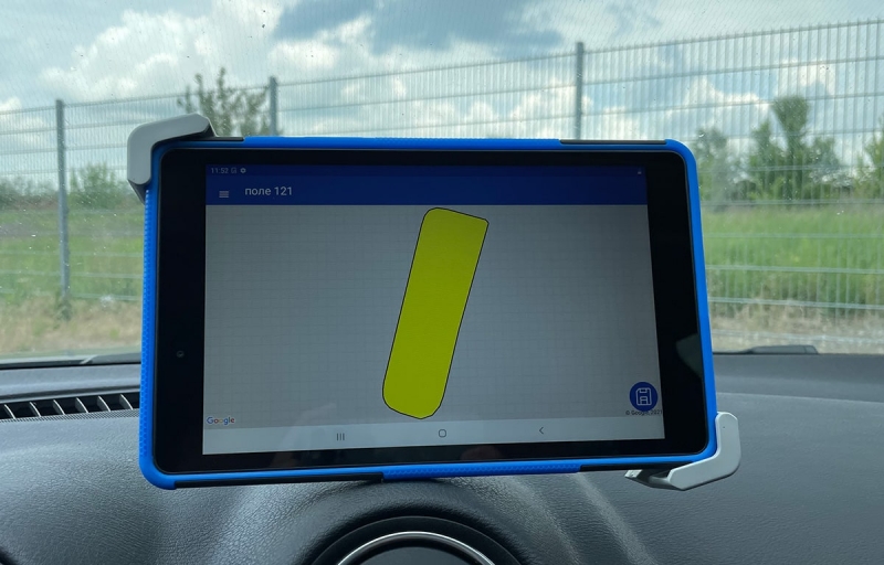
- Attachment for Tablet (suction on windshield)
- Charging-splitter in the heater

CHARACTERISTICS
- Display: 7 inches (17.78 cm)
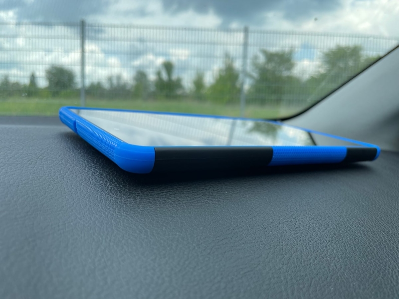
- Case: plastic
- GPS receiver: external SPIKE without built-in battery
- SPIKE receiver power - from the heater 12В
- Cable length 4 meters
- Parallel driving accuracy: basic, 40-50 cm
- Memory card slot: micro SD
- Tablet warranty - from the check store (from 6 months to 12 months, depends on the store)
- Spike Receiver Warranty - 12 months
- Geotrack Technical Support - Included for 3 years
VIDEO DEMONSTRATION IN WORK:
FUNCTIONS:
Accurate parallel driving
Accurate area measurement
Processing Saved Fields
Define Treated Area
Determination of % overlap
Shading of treated area
Display the speed of motion
Azimuth Display
Five driving patterns
Adjust grip width (up to centimeters)
Help directly in the field (connect to the device online)
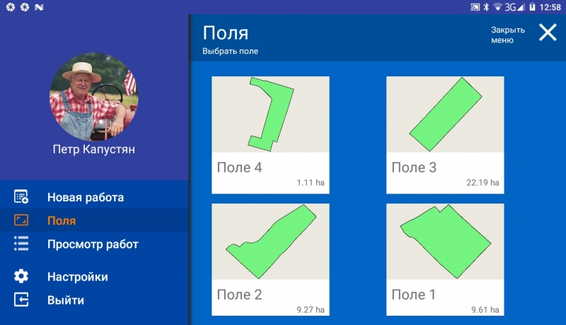
Save Field Map
Save Work
Specify type of work (sowing, spraying, etc.)
Online connection with Agroprofile

NEW OPPORTUNITIES:
- More modes for parallel driving
- RTK Signal Support
- Wi-Fi synchronization with the online system Agroprofile
- Synchronization by 3G/4G/LTE with the online system Agroprofile
- Online work monitoring (updates on the server every 5 minutes, provided that mobile Internet is available) - 12 months free of charge, then (option) 60 y.e./year
- Work planning together with Agroprofile
- Select Work Type
- Division selection (for large enterprises and holdings)
- Execution of scheduled works from the list of works
- Work with centimetre precision (+ GM PRO RTK)
- Automatic disconnection of sprayer sections (option)
- Autorouting connection (option)
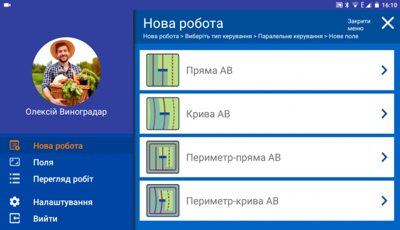
MODES OF OPERATION:
- Measuring Field Area
- Measure the area of offset fields
- Random
- Direct AB
- Curve AB
- Perimeter-Straight AB
- Perimeter-Curve AB

DURING MOVEMENT DISPLAYS DATA:
- Processed Area
- Total length
- Speed of movement
- Number of satellites
- Quality of satellite signal (HDOP)
- Visual Control Tips
- Running Time Count
- Overlap Count
- Ratio: work done / work remaining
- Ratio: treated area/overlap area
Driving mode 2D/3D
Day/Night Mode
- manual switching
- automatic switching at a given time
Work planning (can be used as desired):
In the personal account of Agroprofile, the work is assigned, which on the specified day is automatically displayed in the section "View work":
- "New Work"
- "Section of works sent for recall "
- "Complete Work Section."
ADDITIONALLY:
- Official product page
- Free online system Agroprofile
- Learn more about Agroprofile
QUALITY CONTROL OF WORKS
The new GeoTrack software has many functions for determining the quality of work: displaying the processed area, highlighting overlaps in darker color, counting % of overlaps. The system automatically captures the quality of field processing in real time. Now you will know exactly how well the field has been processed.
FULL SYNCHRONIZATION WITH THE OFFICE
With the help of wireless data transmission, the course indicator can be constantly in communication with the online office Agroprofile. The manager or accountant will be able to monitor progress in real time. The entire eco-system from GeoMeter company allows you to change the quality of preparation and performance of work for the better.

TECHNICAL SUPPORT WITHOUT A SPECIALIST
It is very important to receive technical support from the supplier at the right time. And GeoMeter company took this into account in its new development: all GeoTrack Explorer NEW devices can be checked and maintained using remote access, a company specialist will be able to connect to your display without leaving the field. To use this feature, you will need an installed SIM card with activated Internet access, or a connection to an Internet access point via Wi-FI.

FUEL ECONOMY
Accurate parallel driving between the rows will not allow you to return to the covered areas for their refinement. The processing of the field for you will become controlled and more accurate.
SAVING TIME AND MONEY
The GeoTrack parallel driving system is capable of working at any time of the day, in any weather, in conditions of fog, dust and poor visibility.
SAVING HERBICIDES AND SOWING MATERIALS
The GeoTrack course indicator will allow you to accurately control the technique between rows, which in turn will allow you to correctly and economically distribute herbicides, sowing materials and other resources during field work.
MAXIMUM POSSIBILITIES WITH AGROFILE SYSTEM
The free online system Agroprofile will complement the functionality of GeoMeter and GeoTrack navigation instruments with a full-fledged agricultural planner, the opportunity to get extended information about each field, including weather for each site, field processing history and many others. Accounting, control, planning and analysis of the efficiency of business processes - with all these tasks will help to cope with the online system Agroprofile.

- Producing country Ukraine
- Display 7 inches (17.8 cm)
- GPS receiver GM Target
- Display protection dust and moisture
- Accuracy 40-50 cm
- Types of signal GPS/GLONASS
- Update frequency 10 Hz (10 times per second)
- Antenna cable 4 m
- Memory card Micro SD, 8 GB
")
")